

Drone photography delivers something ground-level cameras simply cannot: a true aerial perspective that changes how subjects, landscapes, and environments read in a single frame. The core reasons to use it are perspective, safety, cost efficiency, and storytelling power. Whether you’re a creative building a portfolio or a business trying to stand out, aerial imaging gives you angles that were once reserved for helicopter budgets. Platforms like DJI and Autel Robotics have brought capable hardware within reach of individual photographers, making this a genuinely good time to start.
Here’s what drone photography unlocks at a glance:
- Aerial perspective: Reveals patterns, scale, and spatial relationships invisible from the ground
- Safety: Inspects hazardous or hard-to-reach structures without putting people at risk
- Cost savings: Replaces helicopters and cranes with a fraction of the logistical overhead
- Marketing impact: Produces visuals that improve brand engagement and audience attention
- Storytelling range: Adds cinematic movement, smooth pans, and tracking shots to any project
- Accessibility: Democratizes aerial views that were once exclusive to large productions
How drone photography transforms your visual perspective
The most immediate shift when you fly a drone is compositional. From the air, the world reorganizes itself. Roads become leading lines. Forests turn into textures. A mountain trail that looks chaotic at eye level reveals a clean S-curve from 50 meters up. That reorganization is the whole point.
Ground-level photography is constrained by the human vantage point. You can move left, right, crouch, or climb a ladder, but you’re still working within a narrow vertical band. A drone breaks that constraint entirely, giving you a vertical range that changes the geometry of every scene you shoot.
Specific perspective shifts drones make possible:
- True bird’s-eye view: Shooting straight down reveals patterns and formations that are invisible from any ground position
- Elevated three-quarter angles: Show a subject and its full surroundings simultaneously, giving viewers spatial context
- Dynamic tracking shots: Follow a subject through terrain with smooth, flowing motion that no ground rig can replicate
- Seamless panoramas: Hover in place and sweep a wide vista without the jitter that plagues handheld panoramic attempts
- Low-altitude weaving: Fly through tight spaces or close to the ground for cinematic proximity shots
Drone videography adds another layer: real-time camera movement control lets you adjust framing mid-flight, so you’re not locked into a fixed angle the way you would be with a tripod or even a gimbal on the ground. That live feedback loop is what separates aerial footage from a lucky helicopter shot.
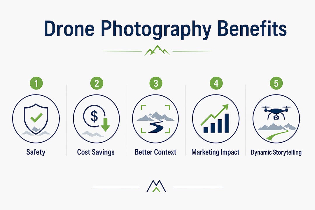
Key benefits of drone photography for creative and professional use
The practical advantages stack up fast once you move past the visual appeal.
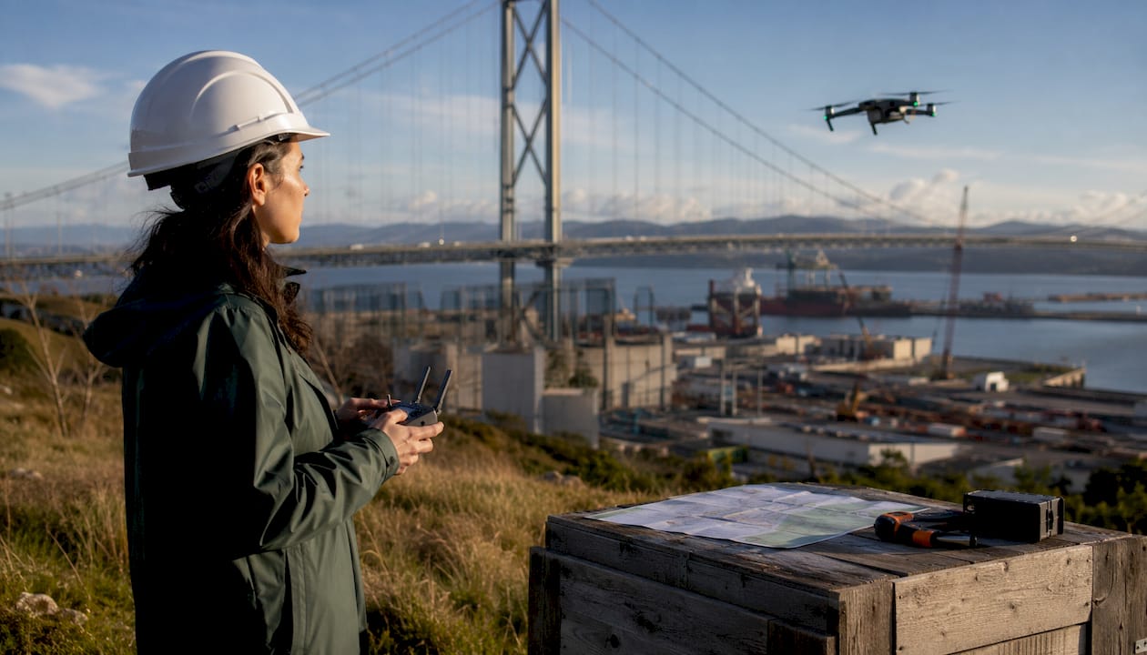
Safety comes first. Drones inspect hazardous areas like bridges, towers, and rooftops without requiring workers to climb scaffolding or operate lifts. In construction and infrastructure, that reduction in physical exposure translates directly to fewer job-site accidents.
Spatial context changes how clients understand what they’re buying. Overhead views reduce terrain distortion and show the relationship between a property and its surroundings in a single frame. Aerial imagery in real estate and construction gives planners and buyers information that a ground-level photo simply cannot communicate.
Cost efficiency is real and measurable. Professionals using drones need fewer crew members, shorter setup times, and minimal maintenance compared to helicopter or crane-based shoots. That lower overhead makes frequent aerial shoots financially viable for projects that would never have justified a manned aircraft.
Marketing results improve. Aerial visuals create memorable impressions and strengthen visual storytelling in ways that lift customer confidence and brand differentiation. Businesses that use aerial imagery consistently tend to communicate value faster than those relying on standard ground-level shots.
The benefits of drone videography extend into outdoor videography storytelling as well, where dynamic movement and cinematic range make the difference between footage that holds attention and footage that gets scrolled past.
Practical tips to improve your drone photography results
Most beginners make the same mistake: they fly as high as the drone will go and wonder why the photos look flat. Maximum altitude flattens everything. Roads, rivers, and trails lose their spatial relationship to the landscape and collapse into abstract patterns. Mid-altitude flight preserves three-dimensional depth and keeps leading lines readable.
A few habits that separate good drone shots from forgettable ones:
- Fly at mid-altitude first. Work the 30–80m range before pushing higher. Subjects retain context, and leading lines stay compositionally useful.
- Shoot during golden hour. Low-angle morning and evening light adds shadow and texture that flat midday sun destroys. Weather matters too: overcast days soften contrast, but high winds or mist will ruin footage.
- Master the controls before chasing shots. Smooth, deliberate stick inputs produce stable footage. Jerky corrections show up clearly in video.
- Get FAA Part 107 certified for commercial work. If you’re shooting for a client or selling images, U.S. law requires it. The certification involves a knowledge test and real preparation time.
- Compose with intent. Ask yourself what the aerial view adds to the story before you take off. If the answer is “nothing,” a ground shot might serve the image better.
- Use the straight-down shot deliberately. Shooting directly below reveals patterns and formations that surprise even experienced photographers, but it works best when there’s genuine geometry to reveal.
Pro Tip: Avoid the “maximum altitude trap.” Flying at the drone’s ceiling looks impressive in the moment but often produces images where everything reads as equally flat and distant. Drop to 40–60 meters and reframe. The difference in depth and subject presence is immediate.
For photographers looking to improve their outdoor shoots, drone work rewards the same discipline as ground photography: deliberate composition, good light, and a clear reason for every shot.
Common challenges in drone photography and how to handle them
Drone photography has real friction points. Knowing them before you invest saves time and money.
Battery life is the hardest constraint. Most consumer drones offer limited flight time per charge, typically around a couple dozen minutes. That sounds adequate until you factor in takeoff, repositioning, and the time it takes to find a composition. Carry multiple batteries and plan your shots before you fly.
Weather grounds you more often than you’d expect. High winds, rain, and even heavy overcast can make flying unsafe or produce unusable footage. Build weather flexibility into any shoot schedule, especially for outdoor and landscape work.
Regulatory restrictions are non-negotiable. The FAA controls U.S. airspace, and getting started with drone regulations is the first step any new operator should take. No-fly zones cover airports, national parks, and many urban areas. Flying without awareness of these rules risks fines and equipment confiscation.
Image quality involves trade-offs. A high-quality consumer drone camera tops out around 20 megapixels with a sensor smaller than a traditional DSLR. You gain mobility and perspective; you give up some of the fine detail control you’d have with a full-frame camera on the ground.
Key challenges and practical responses:
- Short battery life: Carry 3+ batteries, pre-plan compositions, and use the first battery for scouting
- Wind sensitivity: Check forecasts with apps like UAV Forecast before heading out; fly below the wind layer when possible
- Airspace restrictions: Use the FAA’s B4UFLY app to verify legal flying zones before every session
- Image quality limits: Shoot in RAW format when the drone supports it, and use post-processing to recover detail
- Privacy concerns: Respect property boundaries and avoid hovering over people without consent
What Martin Bissig has learned from aerial photography in the field
Martin Bissig has spent years shooting outdoor and adventure subjects across locations from the Swiss Alps to California and Pakistan, working as a Canon ambassador and producing commercial and editorial imagery for brands that need visuals to carry real weight. That field experience shapes a clear view of what aerial photography actually delivers versus what beginners expect.
From a commercial standpoint, Bissig’s work illustrates how aerial imagery strengthens adventure branding by showing context that ground-level photography leaves out. A rider on a trail looks impressive close up. From 60 meters above, you see the trail’s relationship to the mountain, the valley below, and the exposure of the line. That context is what sells the story to a magazine editor or a brand’s marketing team.
The operational efficiency argument holds up in the field too. A drone covers terrain in minutes that would take hours to access on foot with a traditional camera setup. For expedition work in remote locations, that speed matters as much as the perspective itself.
Photographers who want to understand how professional outdoor photography integrates aerial work into a broader visual strategy will find that the drone is a tool, not a shortcut. The same principles of light, composition, and storytelling intent apply at 50 meters as they do at ground level.
Key Takeaways
Drone photography’s core value is the aerial perspective: it reveals spatial relationships, scale, and context that ground-level cameras cannot capture, while also reducing costs, improving safety, and strengthening visual storytelling across creative and professional applications.
| Point | Details |
|---|---|
| Fly at mid-altitude | The 30–80m range preserves depth and keeps leading lines compositionally readable. |
| Safety advantage | Drones inspect hazardous structures like bridges and towers without putting workers at risk. |
| FAA certification required | Commercial drone operators in the U.S. must hold an FAA Part 107 Remote Pilot Certificate. |
| Cost efficiency | Drones need fewer crew members and less setup time than helicopter or crane-based shoots. |
| Marketing impact | Aerial visuals strengthen brand storytelling and help businesses communicate value faster than standard ground-level imagery. |
Aerial perspective is one of the most direct ways to upgrade the visual quality and storytelling depth of any photography project. If you’re ready to go deeper into outdoor and adventure imagery, Bissig’s guide to outdoor photography styles and techniques covers the foundational skills that make drone work land harder. And if you’re thinking about how to market your drone photography services, SEO for photographers is worth a look for getting your work discovered online.


